top of page

MANOWL IMAGING
Aerial Survey & Mapping

Our Work
Our Work: Clients
 Sepadok River Update |
|---|
 Orthomosaic Field Road Update |
Orthophoto
Ortho mapping is the process of stitching many pictures into one large picture and generating a map and data to reference orthographic (geographic) information.
 B4 Block Orthomosaic Palm Analysis |
|---|
 Block A Palm Census |
 Lot 21 & 22 Palm Tree Census |
Tree Counting
Tired of ground land census? We help to reduce your energy and time with high resolution orthomosaic map to make the tree analysis. Fast & Cheap!!!
 NDVI (Plant Health) |
|---|
 NDVI Block C |
Normalize Difference Vegetation Index
Measure the health and plant density of crops. We help client to create Normalized Difference Vegetation Index (NDVI) map to monitor which crops are doing well and which need more care.
 Flyover Construction Progress |
|---|
 Site Cleared |
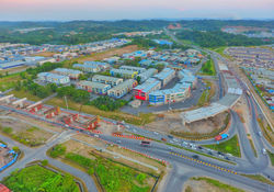 Flyover Construction Progress |
Site Inspection
Aerial view of the job site allows client to monitor and report on progress, infrastructure, equipment, and construction plan.
 Hill Terracing 3D model |
|---|
 3D Model Quarry |
3D model
3D model map for client so that they can visualize & plan based real earth topography.
bottom of page